

THE SITUATION:
Until my final year of University, I had always been one of those people who could not understand how anyone could find enjoyment in walking long distances. In my (potentially still undeveloped teen) mind, only shopping, eating, hanging around boys, watching tv episodes, and only going for a walk to the dairy, were sources of enjoyment. Of course I had always played sports, and been relatively active, but walking for long stretches of time, in cold temperatures, or blistering hot ones, for no other reason than just for fun, seemed totally crazy!
But for some reason, whether it was just a new-found maturity (ha) or there was something in the air, I was hooked! and that small spark turned into a new interest into the world of outdoor activity.
If you have checked out my Instagram account recently (do it now!) then you will see I’ve gotten into doing walks, and getting outside as much as I can, especially in summer. But I had never done a serious tramp that went for more than 4 hours, or spanning a few days.
So this last weekend, when a friend offered me the opportunity to come with her, I jumped at the chance! And so I went on my first 2 day tramp, covering approx 41 kilometres, around 6 hours of walking the first day, and 4 hours the next day.
What other people thought of this walk:
Rankers – Lake Rotoiti Circuit Track
TRACK OVERVIEW:
Track Overview

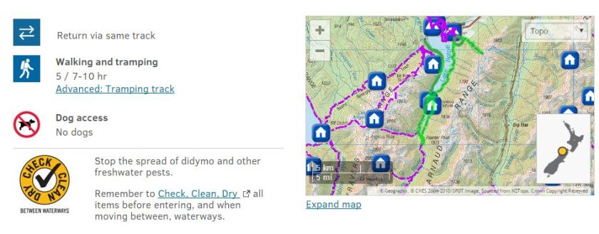
Nelson Lakes National Park is situated in the north of New Zealand’s South Island. The gateway to the park is St Arnaud, a 1-2 hour drive from Nelson or Blenheim. Our trail would be the popular Lake Rotoiti Circuit, an estimated 7-10 return.
Because it was a long walk to complete in one day, we chose to walk to Coldwater Hut, stop for lunch, continue to the Swing Bridge, and then finish the day at Lakehead Hut before walking back to Kerr Bay and then to the car the next day.
Helpful Links:
Department of Conservation – Lake Rotoiti Circuit
THE PLAN:
To start, my friend has experience with tramping, and was really passionate and helpful when we began planning. If it wasn’t for her knowledge, I probably wouldn’t have to survived.
Firstly, we decided on our route, what time we were going, when we expected to get back, and which hut we were staying at, all very practical (I felt like a professional tramper already).
Then we set about buying our provisions (omg camping food is so much better than regular food!) We bought:
- 2-min packet noodles, which are light and easy to carry
- Canned spaghetti with meatballs
- Bacon for breakfast
- Marshmallows and Choc Wheaton’s for s’mores!
- Trail mix
- Winegums and Werther’s Original caramel lollies
- Snack bars
And let me tell you, I probably would have collapsed and cried without the lollies. Those sweet little morsels of sugar helped keep my energy up, and I ate them constantly as we walked when i was feeling low.
The Other Half also came in handy as he had had survival training and outdoor experience, and helped me pack my backpack. Without him, I may have tried to take 5 pairs of socks, a super thick jumper, and half my wardrobe. And who knew it was so hard to pack a sleeping back with no case (actually I wouldn’t know, as he did was the one who had to make it fit!)
Know before you go:
DAY 01.
Beginning at the sloping Mt Robert carpark, around 10 minutes drive from the alpine town of St Arnaud, we began our long walk to Coldwater Hut at the head of Lake Rotoiti. This leg of the hike took around 3 hours, with a short stop to gaze at the amazing Whiskey Falls waterfall (cool name huh).


The air was fresh and a little damp, but we were fortunate it didn’t rain. The grey sky tantalised us with patches of light, but sadly there wasn’t much warmth in it. The track was rutted in places, and had treacherous tree roots clawed through it, but was an easy gradient, with few steep parts. Because of the amount of rain in the area the last few days, a lot of the rivers were up and surging, as well as rivulets running through the grooved parts of the trail. As we trod on, I was so glad for my boots, a purchase I had made a few weeks back in the hope that I would get to do more rugged walks. Thank god for their stability and rugged soles, as the track was slippery for most of the weekend. I was also immensely glad for the small break we took for lunch. It was there, at Coldwater Hut, in that picturesque place looking out over the still grey lake, that I felt a surge of wonder, and gratitude that the country I lived in was so beautiful, and that we had these walks at our doorstep. And also FOOD, I was very glad to wolf down our lunch food.


Because the route we originally wanted to take (an easy crossing over the normally low Travers River) was swollen with white water, we had to walk another 1.5 hours up to the Swing Bridge. Although my blisters weeped, I was still excited by this new direction, as who doesn’t love a good swing bridge! And we weren’t disappointed. It was high above the swirling icy waters, at the very peak of the Travers Valley, and swayed gently as we crossed (or bounced violently, depending on how much fun we were having).


From the swingbridge, our final destination for the day would be Lakehead Hut, another 1.5 hours in front of us. As we wearily trudged (well, my friend paced it because she is amazing) I felt so proud I had made it this far. Honestly I got a bit worried I would attempt to give up, or my wobbly legs would give up. But as the the small hut rose up from the bushes and into our sight, I knew we would make it, and complete a decent walk that day.
A group of gentlemen had reached Lakehead Hut before us, and very graciously lit our fire, before kayaking back over to Coldwater Hut for the night. This small bit of kindness really made our night, as we could collapse in the warmth for a bit before thinking about dinner. DOC had recently put in a new fireplace, which blazed to life after we fed it dry wood from right outside the hut. The hut itself was a perfect size, spartan in decoration, but homely and comfortable nonetheless. It could house around 30 people, and had large platforms with single mattress (think REALLY big bunkbeds). So I was definitely pleasantly surprised, as I thought I would be cold, wet and uncomfortable all night.


After we had hobbled around unpacking and throwing on our warm cuddly gear, we set about making dinner. Oh how I had been dreaming about hot tasty noodles all day, and they did not disappoint. We cooked them in boiling water over the fireplace, and they ready in minutes for us so slurp down. After came the much awaited S’MORES! We had pulled our mattresses onto the floor in front of the fire in anticipation of this moment. Impaling our marshmallows on twigs from outside, we spent a relaxing hour toasting the little sugar sponges, blackening the edges, before smooshing them onto Choc Wheaten biscuits and devouring them.
Finally, with the firelight flickering peacefully, we fell asleep, rugged up in sleeping bags and gently warmed by the fire.
DAY 02.


The morning came too quickly, bringing beautiful bright day, and also achy muscles and sore feel. My body creaked and rattled as I stood up, as did my friends, as we began to tidy up and re-pack our backpacks.
With a warm breakfast of bacon and spaghetti meats in our bellies, and a last goodbye to our wonderful hut, we set out along the Lakehead Track, along the eastern shore, and away from the stunning snow-capped peaks of the mountains surrounding us.
The next 3 hours definitely tested my endurance, and there were times again when I thought I might collapse into a ball of self pity and moaning muscles. But my walking partner kept up a perfect pace, meaning we reached Kerr Bay on schedule, if not a little before our estimated time. I had never been so glad in my life to see the familiar carpark and families playing by the water. It meant we were back in civilisation, and only about an hour and a half out from the car, after we had walked around the Peninsula. Too bad last half an hour was probably the hardest part of the whole walk. Trudging up the road, a far cry from the pitted track we had been following, I prayed to see our little car around the next bend…the agony was crushing when we kept realising it was around the next corner.


But finally (after much internal screaming and crying on my part) we reached the car, just as the weather packed up, the fog rolled in, and the rain started to tap us on the shoulder to hurry up. Taking the the hint and piling into the car with bare feet and exhausted smiles, we began the drive home (after a sneaky stop for hot chips and sweet drinks).
This 2-day trail has been amazing, challenging, beautiful and inspiring all at the same time. The stunning landscape of the alpine ranges, rugged charm of the back country, and the stark beauty of nature in motion, gave me some perspective on my day to day life, and has really pushed me to continue to explore and challenge myself.
The trip itself was an amazing chance to explore New Zealand’s walking and hiking trails, and was one of the most rewarding ways to experience the country’s outstanding natural beauty. There are only so many postcards, tv commercials, and websites highlighting the exceptional things you can do in New Zealand, before you really have to just get out there yourself, with friends, with family, and give it all a go. And I intend to! And I hope I meet more people along the way who would be a part of these amazing adventures, and maybe who ever reads this might be inspired to explore a little bit more themselves 🙂
Happy adventuring!
Nic x
![]()

Thanks for the blog Nic! Definitely helps me with my planning to Nelson Lakes. Have a question for you if you mind answering. I’m planning on doing the half day hike and taking the water taxi half way. Would you say the West Side was better than the East? Looks like West is better given Whiskey Falls. just wanted to know your opinion.
LikeLiked by 1 person
Hi Spencer thanks so much for your question!
The west side is more scenic with the Whiskey Falls definitely, and you walk close to the lake most of the way giving you a stunning view across 🙂 And when it gets super hot, it’s the best side to have a paddle on haha
LikeLike